
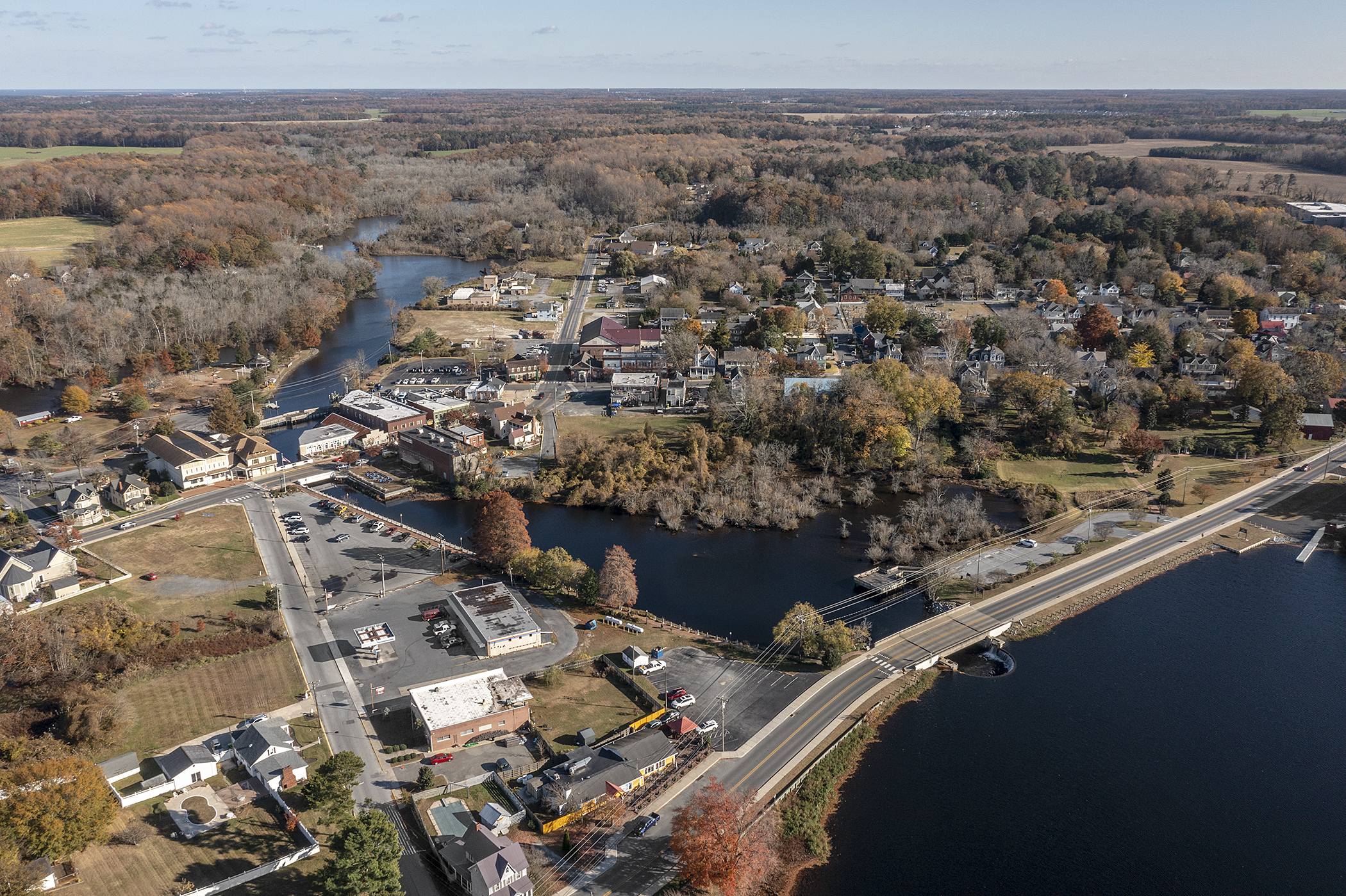
More aerial photos of Milton have come to light, courtesy of the Delaware Public Archives. These come from a flight made around 1970, although it is unclear whether this was via a small plane or a balloon. The photo I have chosen for this post displays the downtown area just east of Mulberry Street and includes part of Wagamon’s Pond, the Broadkill River, and Union, Front, Federal, and Chestnut Streets. The seventeen buildings or clusters of buildings numbered in this photo have all disappeared in the last 50 years.
With the invaluable assistance of life-long Milton residents Jack Bushey and Fred Pepper, I’ve been able to identify each of the numbered buildings in the photograph.
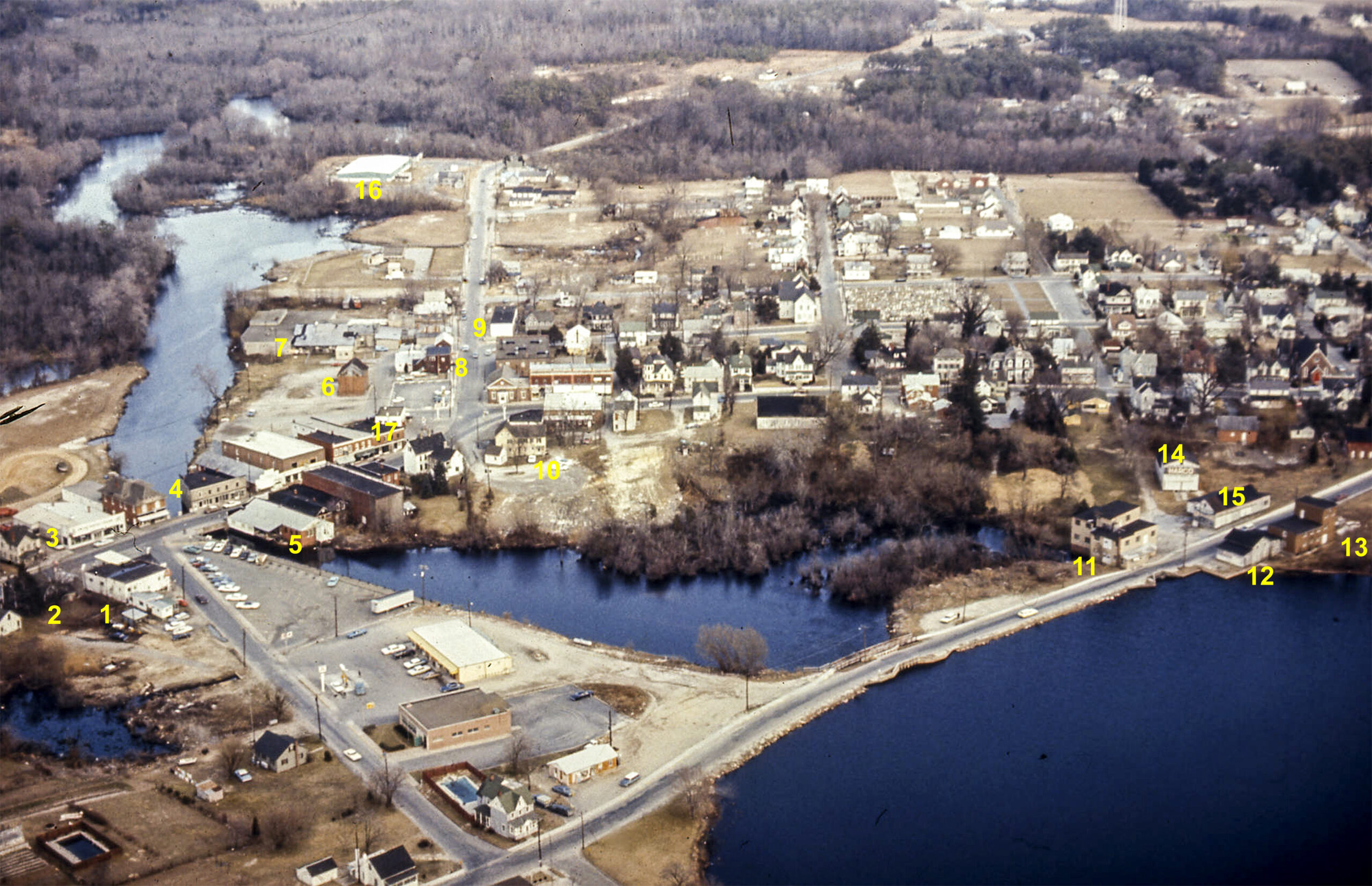
To keep things from getting the narrative too complicated to match against the picture, I will split the photograph into two sections. The first encompasses Union, Magnolia, and Front Streets, where most of the vanished buildings stood. The second section encompasses the cluster of buildings on either side of Mulberry Street, replaced today by fishing piers and Governors’ Walk.

- Ed Scott’s Service Station occupied much of the lot which is owned today by the Milton Historical Society.
- Vacant house (last occupant unknown); to its left is the rear of a a white building that was once the Grace Church Social Hall. At the time of this photo, Grace Church had been defunct for several years, and the building was being used by a succession of small businesses.
- Originally the Lippincott Button Factory, subsequently a car dealership and finally Milton Service Center; the latter was in business at least until 1989 or 1990, selling fuel oil and propane, as well as some home appliances. Structure was torn down for the expansion of the Milton Public Library to its right (completed 2004)
- Drug store and Post office; building owned by Joseph Walls in the 1950’s.
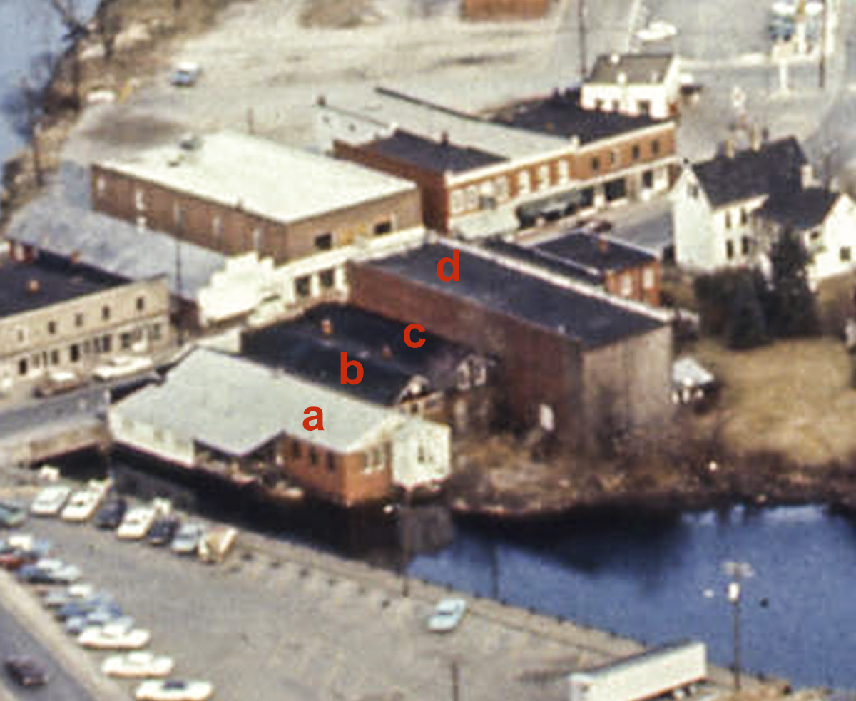
- See photo detail below
6. Edgewater Milling Co., a remnant of the Royal Packing Co.
7. Milton Poultry processing plant
8. Sussex Tavern and Milton Cleaners
9. Apartment building
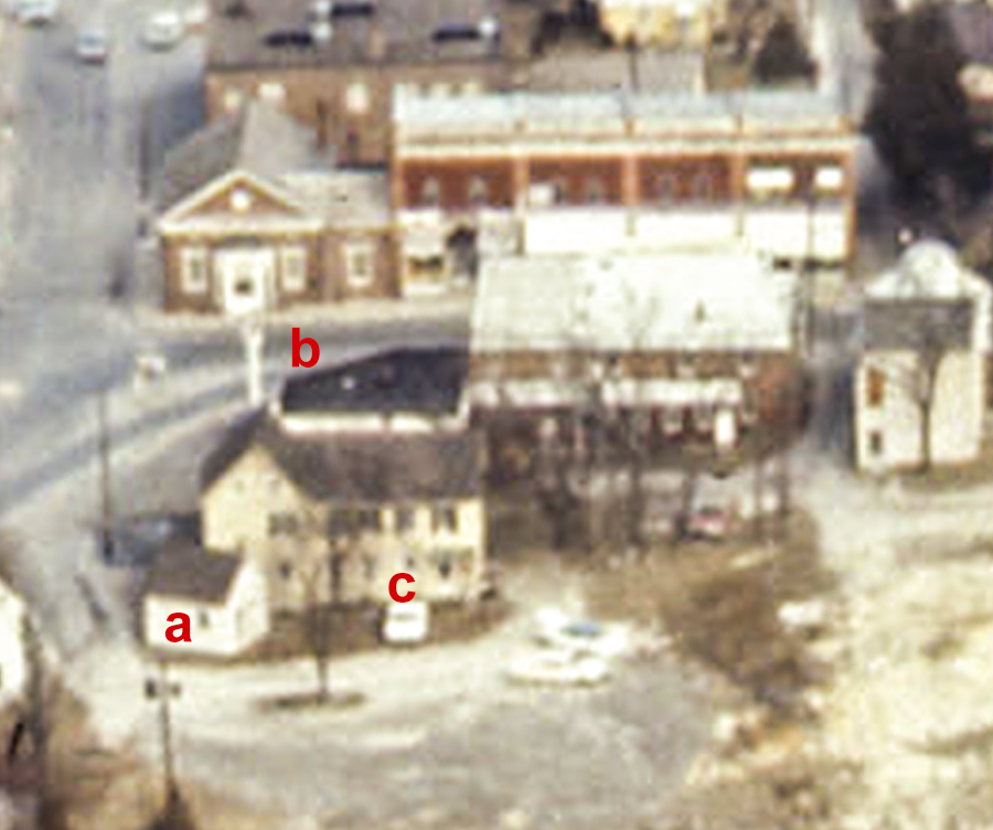
10. Refer to photo detail below
16. Dulany cooling station, associated with the canning of lima beans
17. See photo detail below
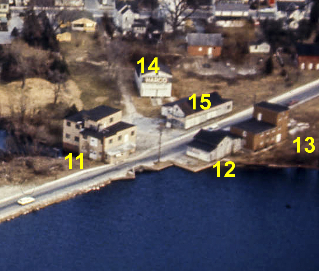
11 – 15 are all buildings that were part of Diamond State Roller Mills, owned by by H. K. Wagamon and his family since 1901, when they replaced the original 19th century mill. The 1901 mill was destroyed by fire in 1942, and a replacement built in 1943; (11) is the main building. Closed in 1958, it fell into ruin and was destroyed by a controlled burn in 1972, some time shortly after this aerial photograph was taken.
Big changes came to the downtown area after the 1970 aerial photograph was taken. The former Grace Church building was purchased by Lydia B. Cannon and donated to the Milton Historical Society in 1971; structures (1) and (2) were eventually demolished and the Historical Society took possession of the entire lot (readers are invited to comment on when those structures were demolished). A new bridge over the Broadkill/Wagamon’s Pond inlet can be seen in the photograph as well. Only one gas station remains downtown, on Magnolia Street. Where there once were two mills, a chicken plant, a button factory, and a lima bean drying facility, there are no industrial facilities at all in the heart of Milton, nor any pool halls or pinball arcades. The only significant industrial operation, Dogfish Head Brewery, lies at the south end of Chestnut Street near the town’s edge.
Thanks, Phil. Always informative and nicely researched.
Bruce, your interest is much appreciated!
I remember this all so well! I was married v that same year in Goshen church and had my reception in the Goshen fellowship hall!
So much has changed, hasn’t it?
Number 3 is wrong. It is the Milton ServiceCenter. Number 1 is Ed Scott’s service station.
You and Robert Carey caught my mistake, and I’ve corrected it in the post. Thanks for the sharp lookout!
Are you sure you do not have 1 & 3 reversed?
Yep, you’re right!
When I lived in Milton in the 1950’s, Ed Scotts’s service station was located on the area you have as 1, which the Milton Historical Society owns today. I also think the Milton Service Center was located in the area you have as 3.
I will always remember Ed’s pet monkey, which he took everywhere on his shoulder.
You and Jack Hudson caught my mistake, and it has been corrected. The story of Ed Scott’s pet monkey is an interesting one, and could only have come from a long-time resident of the town. Thank you.